This is one of the many tests I’m doing to compare GPS/GNSS receivers.
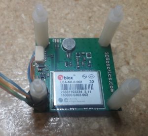
I’ve had this u-box LEA-6H unit for about five years. It was the GPS that came with the 3D Robotics ArduPilot that I’ve been using on my quadcopter.
I logged data from the unit for ~41 hours at a rate of 4 measurements per second (584,075 data points).
I converted the 53044 data points to NZTM, calculated the average point and then subtracted this average point off every other data point.
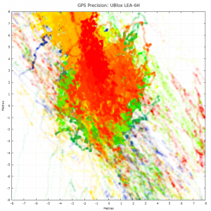
Here’s a graph of those results. Centre of the graph is the position averaged over the full dataset. The colour of each point represents the age of the measurement from oldest to newest – blue, green, yellow, orange and then red.
This GPS performed very poorly. The total dataset spanned 690m North-South and 452m West-East, but even when concentrating just on the 16m wide graph above, the GPS seemed to be all over the place.
It will be interesting to see the results of some of the other units.


